Mapping the Red Planet: How NASA's Ingenuity Replaced GPS for Perseverance on Mars
On Earth, navigating from point A to point B is often taken for granted. We pull out our smartphones, and within seconds, a constellation of Global Navigation Satellite System (GNSS) satellites — like GPS, Glonass, or Galileo — provides our precise location. This ubiquitous technology underpins everything from self-driving cars to emergency services. But what happens when you’re millions of miles away on another planet, where no such infrastructure exists? This is the formidable challenge NASA's engineers faced with the Perseverance Mars rover, and their solution is a testament to human ingenuity.
The Martian Navigation Conundrum: A World Without GNSS
Mars, unlike our home planet, lacks the extensive network of orbital satellites necessary for traditional GNSS functionality. For previous missions, rovers often relied on slower, more laborious methods: taking images, sending them back to Earth for human operators to analyze and plot routes, and then uploading commands. While effective, this process is time-consuming, limits autonomy, and can be fraught with delays, especially in complex or unknown terrain. As missions become more ambitious, demanding greater independence and faster decision-making on the surface, a more robust and autonomous navigation system became critical.
Introducing Mars Global Localization: A Celestial Mapmaker
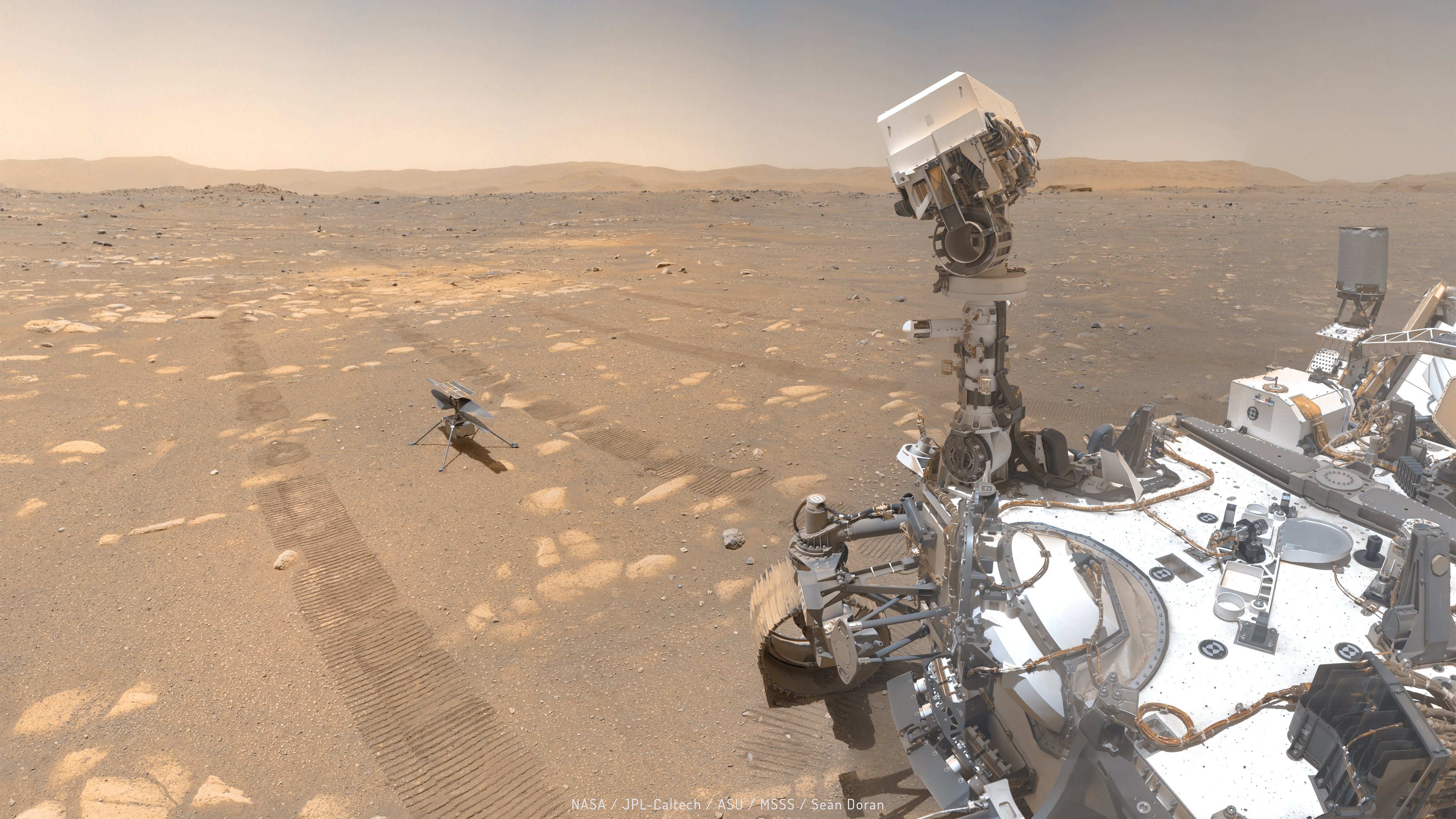
NASA's Jet Propulsion Laboratory (JPL) engineers, ever at the forefront of innovation, developed a groundbreaking alternative: "Mars Global Localization." This sophisticated system essentially allows the Perseverance rover to become its own cartographer and navigator, leveraging existing resources in a novel way. At its core, Mars Global Localization operates by creating highly detailed, high-resolution maps of the Martian surface using data from orbital assets, most notably the Mars Reconnaissance Orbiter (MRO). These "basemaps" are incredibly precise, showing topographical features, rock formations, and even subtle changes in the terrain with unparalleled clarity.
The magic happens when Perseverance uses its onboard cameras. As the rover moves, it captures images of its surroundings. These images are then compared in real-time with the pre-loaded orbital basemaps. By identifying distinct landmarks, geological features, and patterns visible in both its current view and the detailed map, Perseverance can accurately pinpoint its exact location. This process, akin to a human explorer using a detailed paper map and their surroundings to know where they are, but at a vastly more precise and automated scale, is a game-changer.
Beyond Traditional Methods: Enhanced Autonomy and Safety
The implications of Mars Global Localization are profound. Firstly, it dramatically enhances the rover's autonomy. Instead of waiting for directives from Earth, Perseverance can navigate more independently, making quicker decisions about its path, avoiding hazards, and optimizing its scientific routes. This not only accelerates the pace of exploration but also reduces the operational workload on ground teams, allowing them to focus on more complex scientific planning.
Secondly, precision is paramount on a rugged and unforgiving planet like Mars. Mars Global Localization offers a level of positional accuracy that was previously difficult to achieve without constant human intervention. This precision is vital for tasks requiring exact positioning, such as drilling for samples, deploying scientific instruments, or safely traversing treacherous terrains like boulder fields and sand dunes. By knowing its location with greater certainty, Perseverance can mitigate risks more effectively, safeguarding the invaluable asset that it is.
Future Implications: Paving the Way for Deeper Space Exploration
The success of Mars Global Localization extends far beyond the current Perseverance mission. This innovative approach to off-world navigation lays crucial groundwork for future human missions to Mars and beyond. Astronauts will require reliable and independent navigation systems to explore safely and efficiently, establish bases, and conduct extravehicular activities. This technology could also be adapted for missions to other celestial bodies, such as the Moon, asteroids, or even moons of gas giants, where traditional GNSS constellations are non-existent.
Imagine a future where autonomous robots can explore lava tubes on the Moon or navigate the icy plains of Europa, all guided by similar self-localizing systems. Mars Global Localization represents a significant step towards enabling greater independence for extraterrestrial operations, reducing reliance on Earth-bound infrastructure, and opening up entirely new possibilities for scientific discovery and human expansion into the cosmos.
Conclusion: A Beacon of Innovation
NASA's JPL engineers have once again demonstrated their remarkable ability to solve complex problems with ingenious solutions. By transforming orbital imagery and onboard camera data into a powerful navigation tool, they have not only ensured the continued success of the Perseverance rover but also charted a new course for how we will explore distant worlds. Mars Global Localization isn't just a replacement for GPS; it's a beacon of innovation, guiding humanity further into the vast, unknown expanse of our solar system.